Spatial data to real-world decisions.
About GIS
Why geospatial projects stall
It's rarely the map. Most GIS projects struggle because spatial data lives in silos, tools don't talk to each other, and field teams get stuck switching between platforms instead of doing the work. The engineering underneath - infrastructure, ETL, integrations, mobile - is what separates a cool demo from a system a business actually runs on.
How We Help
Location Intelligence, Made Practical
We meet you where you are - whether you're running a full Esri stack, moving toward open source, or starting fresh - and build toward a geospatial platform that scales with your business.

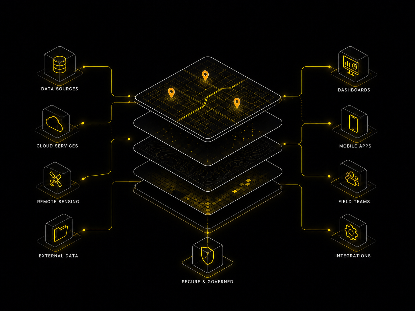
Spatial Data Infrastructure
Our certified engineers design and maintain scalable spatial infrastructures capable of handling thousands of layers and hundreds of millions of records - engineered for performance, reliability, and future growth.
Custom Mapping Solutions
We develop tailored, in-house mapping applications for both internal and client-facing use, designed to fit specific workflows and business requirements - not off-the-shelf tools bent into shape.
Mobile Applications
We build mobile-first geospatial applications that bring location intelligence directly into the field, enabling real-time data collection, visualization, and decision-making where the work actually happens.
Spatial ETL
We design and implement end-to-end spatial data pipelines - covering ingestion, transformation, and delivery - that can be manually supervised or fully automated with AI-driven processes.
Our Process
From spatial data to shipped systems
Discovery & Spatial Audit
We assess your data sources, systems, and business goals to identify the highest-impact geospatial opportunities and build a prioritized roadmap.
Architect & Prototype
We design the data model and infrastructure, then build a focused prototype against your real data to prove value before committing to full production scope.
Production Build
We engineer the scalable system - spatial infrastructure, mapping applications, mobile, pipelines, and integrations - using modern, production-proven technology across licensed and open-source stacks.
Handoff & Growth
We document everything, train your team, and remain available as a long-term partner as your platform, data, and use cases evolve.
Proof
Built at production scale
Our spatial data infrastructure runs thousands of layers and hundreds of millions of records in production - the kind of system that doesn't forgive architectural shortcuts. We've designed and delivered modern mapping platforms for enterprise real estate operators that unify property data, market intelligence, and internal workflows across distributed teams - so advisors manage entire deal cycles directly within the map, instead of switching between tools.
Our Stack
Built for both worlds
With over 4 years of experience in geospatial technologies, we work across both licensed and open-source ecosystems to deliver flexible, scalable solutions.
The Bottom Line
The platform beneath the map
A map is only a map until someone acts on it. The durable value of GIS is in the infrastructure and pipelines that turn location into decisions that compound - brokers who close faster, field teams who work smarter, and organizations that run on a single source of spatial truth. That's the platform Zaelot builds.
Get in touch
Let's Build Something Great Together
Whether you have a bold idea or a complex problem, we're here to turn it into an exceptional digital product. Tell us about your project and let's get started.